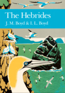
Kitabı oku: «The Hebrides»
Map

Fig. 1 Map of the Hebrides

Copyright
William Collins
An imprint of HarperCollinsPublishers 1 London Bridge Street London SE1 9GF
WilliamCollinsBooks.com
This eBook edition published by William Collins in 2019
First published 1990
Copyright © J. M. and I. L. Boyd, 1990
J. M. and I. L. Boyd assert their moral right to be identified as the authors of this work.
© Textured background for limpback cover
‘Marlmarque’, G. F. Smith & Son
HarperCollinsPublishers has made every reasonable effort to ensure that any picture content and written content in this ebook has been included or removed in accordance with the contractual and technological constraints in operation at the time of publication.
Source ISBN 9780007308514
Ebook Edition © FEBRUARY 2019 ISBN: 9780007406630
Version: 2019–02–26
Note to Readers
This ebook contains the following accessibility features which, if supported by your device, can be accessed via your ereader/accessibility settings:
Change of font size and line height
Change of background and font colours
Change of font
Change justification
Text to speech
[Page numbers taken from the following print edition: ISBN 9780007308514]
Editors
Sarah A. Corbet
Max Walters, ScD, VMH
Professor Richard West, ScD, FRS
David Streeter, FIBiol
Photographic Editor
Eric Hosking, OBE, Hon FRPS, FBIPP
Dedication
TO WINIFRED
wife, mother and grandmother
Contents
Cover
Map
Title Page
Copyright
Note to Readers
Dedication
Foreword by HRH Prince Philip The Duke of Edinburgh
Editor’s Preface
Preface by J. Morton Boyd
Prologue
Islands in Natural History
Island Races
Grand Relationships
Islands for Science
Part I: The Ecosystem of the Hebrides
1.Geology
Geological Framework
Pre-cambrian and Palaeozoic Rocks
Mesozoic Rocks
Tertiary Rocks
Quaternary Features
2.Climate and Hydrography
Climate
The Weather System
Ecological Effects
Humidity and Temperature
Soil Climate
Rainfall and Sunshine
Wind
Climate in the Past
Hydrography
3.Soils
Glacial Till with Brown Forest Soils
Morainic Drift with Peat and Gleys
Outwash Fans and Raised Beaches
Colluvium and Shallow Drifts with Podzols
Aeolian Sand with Regosols
Montane Detritus
4.Life in the Sea
Fish
Benthos
Plankton
Marine Mammals
Turtles
5.The Sea Shore
The Vivid Frontier
Upper Shore
Middle Shore
Lower Shore
Shore Birds and Otters
6.Sand Dunes and Machair
Windblown Sands
Upper Beach and Foredunes
Dunes
Dry Machair
Wet Machair
7.Crofts and Farms
Inbye and Blackland
Patterns of Landuse
Agricultural Habitats
Corncrakes and Corn Buntings
Corncrake
Corn Bunting and Others
8.Woodlands
Tree-growth in the Islands
Native Woodland
Plantations
Woodland Fauna
9.Moor and Hill
Moorland Habitats
Lowland Heath
Bogs and Mires
Blanket and Raised Mires
Valley Bogs
Montane Communities
10.Inland Waters
Physical and Chemical Conditions
Freshwater Vegetation
Brackish Waters
Moorland Waters
Machair Waters
Rivers and Streams
Fish
Reptiles and Amphibians
Waterfowl
Mammals
Part II: Studies of Islands and Species
11.The Seabird Islands
The Islands
St Kilda
The Shiants
North Rona and Sula Sgeir
Mingulay and Berneray
Small Isles
Treshnish Isles and others
Handa
The Species
Fulmar
Manx Shearwater
Small Petrels
Gannet
Cormorant and Shag
Skuas
Gulls
Terns
Auks
12.The Seal Islands
Seals and the Hebrideans
Size and Distribution of the Grey Seal Population
The Breeding Cycle of the Grey Seal
Conservation and management of the Grey Seal
Common Seal
13.The Wildfowl Islands
Islay
Barnacle Goose
Greenland White-fronted Goose
Greylag Goose
Tiree, Gunna and Coll
Uists and Benbecula
Swans
Ducks
14.The Machair Islands
Tiree and the Uists
The Monach Isles
Machair—a Natural Heritage
15.Rum—an Island Nature Reserve
The Volcano
The Forest
Red Deer
Sea Eagles
16.St Kilda—Island of World Heritage
The St Kildans
Rock of Ages
Home of the West Wind
Seabirds of St Kilda
Wrens and Mice
Feral sheep—Soays and Blackfaces
Part III: Islands and People
17.Naturalists and Historians
16th and 17th Centuries
18th and 19th Centuries
First Half of the 20th Century
Second Half of the 20th Century
18.Land Use—Tryst of Man and Nature
Land Use History
Agricultural Improvement
Forestry
Minerals
Ores
Silica
Aggregates, Slates and Block Stone
19.Fisheries and Fish Farming
Fishery History
Demersal and Pelagic Fish
Shellfish
Fish Farming
20.Nature Conservation
Biological Sites
Coastal
Uplands
Woodland
Inland Waters
Peatland and Bogs
Geological Sites
Lewisian, Torridonian, Moine
Mesozoic
Tertiary
Marine Conservation
Nature Reserves
Protected Species
Picture Section
Epilogue
Bibliography
Index
Acknowledgements
About the Publisher
Foreword
 | WINDSOR CASTLE |
It might be said that enthusiasm is the mother of creation. There is no doubt at all about the enthusiasm of the Boyd family for the Hebrides, and it shows in every line of this splendid book that they have created. Having sailed and cruised in Hebridean waters for many years and having acquired an interest in birds, I can quite understand the fascination of that very beautiful part of the world for those with a consuming passion for natural history.
If I had not already been involved in conservation through the World Wide Fund for Nature (WWF), I would have been converted by the changes I have witnessed in the Hebrides over the last twenty years. Plastic flotsam and oil pollution on most of the beaches, the decline in seabird populations and the intensity of commercial fishing reflect what is happening almost everywhere in the world.
I am sure that this book will become essential reading for all students of the Hebrides, and I believe that it will become a ‘bench mark’ for all those who are interested in the natural history of the islands in the future. It will provide an invaluable means of assessing any further degradation of the area, as well as making it possible to measure the success of any conservation efforts.

Editor’s Preface
The Northern and Western Isles of Britain have long drawn the attention of naturalists by reason of their distinct landscapes and their exceptionally interesting communities of animals and plants. Added to this is the attraction of distant islands, with their own cultures and histories, and with climates subject to the severities of the North Atlantic ocean. The New Naturalist Series recognised this interest in the publication of Fraser Darling’s Natural History in the Highlands and Islands in 1947, a book which received acclaim from the wide audience of those generally or especially interested in the wildlife of Britain. More recently, the series has published The Natural History of Shetland by R. J. Berry and J. L. Johnston (1980) and The Natural History of Orkney by R. J. Berry (1985), both continuing the tradition of a broad approach to natural history combined with an expert background of the fauna, flora, environments and history of the islands. An outstanding need in the series has been an account of The Hebrides; the islands lying to the west of the mainland of Scotland, north of the Mull of Kintyre, including the great islands of Mull and Skye and the ‘Long Island’, from the Butt of Lewis to Barra Head of the Outer Hebrides. The diversity of the landscapes in these islands is vast, from the mountainous and fresh scenery of Skye to the ancient lake-filled plateaus of North Uist and the coastal machairs, all with their characteristic fauna and flora. Few know these islands and their natural history better than the authors of this new volume in the series. J. Morton Boyd and Ian L. Boyd both have long experience of the Hebridean islands. Morton Boyd has been intimately concerned with natural history and conservation in the Hebrides since he joined the Nature Conservancy in Scotland in 1957, continuing with the Nature Conservancy Council until recently. Ian Boyd is an authority on sea mammals, especially the Atlantic grey seal, that symbol of marine life in the Hebrides. At a time when issues of wildlife and its future are rightly being more actively considered than ever, the Editors welcome this volume on an area of such diverse and intrinsic natural history interest.
Preface
A visit to Skye when I was six years of age made a deep impression in my mind—wild mountainous scenery, thatched houses, and seagulls over the stern of the paddle steamer Fusileer as she plied the narrow waters between Portree and Kyle of Lochalsh. Little did I know then what a large part the Hebrides were to play in my later life, nor how impressed Dr Samuel Johnson had also been by the same country some two centuries previously—
This (the passage to Raasay) now is the Atlantick. If I should tell at a tea-table in London, that I have crossed the Atlantick in an open boat, how they’d shudder, and what a fool they’d think me to expose myself to such danger … This (the Hebrides) is truly the patriarchal life: this is what we came to find.
It was not until 1948 that I returned to these islands, seeking a new outlook in life after my War Service. I found it in natural history, mountaineering, island exploration, and scholarship. The first three of these were nicely attuned to my natural instinct for an exciting and satisfying life. The last meant a great deal of hard work for me, but my enthusiasm was fired by two men of greater intellect than my own: they were my professor in zoology at Glasgow University, C. M. (later Sir Maurice) Yonge, leader of research on the Great Barrier Reef of Australia, and my mentor in nature conservation, F. (later Sir Frank) Fraser Darling, pioneer ecologist in the West Highands and Islands. Each in his way had successfully combined the outward-bound and intellectual elements of life which I have espoused for as long as I can remember.
It could be said that this book has been forty years in the making. I would not have been convinced that I should attempt it had I not already collaborated with Fraser Darling in the revision of his Natural History in the Highlands and Islands (1947). That work, Number 6 in the New Naturalist Series, was highly popular among students, naturalists and lay readers with an appreciation of wild country, and an awareness of its effect upon people. However, it did receive criticism from academics, who saw the work as lacking in authority and accuracy. One eminent scientist wrote:
Clearly a book like this is exceptionally difficult to write, and most of us would not have the courage to attempt it … (however) … we might well have been worse off with the opposite extreme, a prosy compendium of incredible dullness, richly documented with footnotes.
I had used it as a student, and when I came to revise it I did so without destroying the flow of Fraser Darling’s fine prose. Working from the inside, I could see the great advantages of having the book written by a single author, not just for the writing style, but also for the artistry of compilation behind a single comprehensive work containing the best fruits of many. The alternative is to compile a natural history with many experts contributing one or more chapters in a symposium-type volume, but that is a different type of book altogether from those produced by Fraser Darling (1947), Yonge (1949), Pearsall (1950), and others in the New Naturalist Series. Respectively, these authors were at once expert in one field, and naturalists of broad erudition and experience—interpreters of the broad spectrum, able to see and describe nature in the round.
This is the concluding work in a more extensive endeavour over the last ten years to describe the natural environment of the Hebrides, which in this book embraces all the islands lying off the western seaboard of Scotland, between the Mull of Kintyre and Cape Wrath. The islands of Lewis, Harris, North Uist, Benbecula, South Uist, and Barra and their outliers are the Outer Hebrides; all others, including Skye, the Small Isles (Canna, Rum, Eigg, and Muck), Mull, Tiree, Coll, Jura, Islay, Colonsay, Gigha and their satellites, are the Inner Hebrides. In 1977 and 1981, with the help of others, I organised two symposia on the Natural Environment of the Outer and Inner Hebrides respectively, in the Royal Society of Edinburgh. In doing so I made up my mind to follow the publication of the resultant symposia volumes with a more popular work which would reach a much wider public. These tomes (Boyd, 1979; Boyd and Bowes, 1983), and a major paper in the same series on the non-marine invertebrate fauna of the Outer Hebrides by A. R. Waterston (1981), were useful source works containing 67 papers by some 94 authors. The volume on the Outer Hebrides was followed by Agriculture and Environment in the Outer Hebrides, a report by Dr John Hambrey (1986) for the Nature Conservancy Council, which has also served as a ready source of information.
The writer of a natural history of such a diverse environment as the Hebrides is faced with a vast span in geological age, an enormous number of distinct forms of life, all of which are specially adapted to their living quarters, a wide range of temperate maritime habitats, and a group of human influences and impacts on the environment, rooted in Celtic and Norse cultures, strikingly different from those in mainland Britain. This great assembly is positively dynamic. It is not sufficient, therefore, to provide a ‘snapshot’ of nature today, but also to apply the dimension of history and unrelenting change. To encompass the work in a single volume was firstly a matter of eclecticism and presentation of part of the available knowledge; secondly, of consultation with experts over each chapter; and thirdly, the incorporation of these experts’ comments.
The objective is a wholesome natural history. The chapters do not stand on their own, but are interdependent. They are not specialist essays written without regard to the total ecological purpose of the book or the readership to which it is directed. I am deeply aware that its shape and content are a matter of my personal choice—I found it difficult to decide what should be excluded, and there are many studies which deserve mention and which, in the hands of another compiler, would find a place. The fact that some works are restricted to a mention in the Bibliography does not necessarily reflect their importance in natural history.
I required a co-author to assist me in the review of the literature, primary drafting and editing of my text, the incorporation of expert comment, and the application to the work of the judgment and taste of a younger scientist. I did not require to look further than my second son, Ian Lamont Boyd. He made his first visit to the Hebrides in infancy, and came face to face with his study animal, the grey seal, for the first time on Gunna at the age of 19 months. Throughout his boyhood he was continuously on foot with me in the islands and later, like myself, had the benefit of a broadly-based degree in natural science from a Scottish university. He was awarded First Class Honours in zoology at Aberdeen, followed by a Doctorate at Cambridge with a thesis on the reproductive biology of the grey seal. Ian is now in charge of seal research in the British Antarctic Survey.
Stark rocks stand in the sea:
Curved islands against the sunset.
Oh Hebrides! What are you telling me?
I know wherein thy strength is set.
In thy beauty which I oft-times see
In ancient sea-girt, pillared rock beset,
By thrift and auk and cuckoo-bee.
J. Morton Boyd
Balephuil
Isle of Tiree
Prologue
When I was a little boy the Garden of Hesperides, Hy Brasil and the Hebrides were in a curious way one in my mind. Two of these places are mythical; the Hebrides are real, but they reach into a legendary past and the limbo of my own mind and so, the Hebrides, however romantic they may have been in their beginnings in me, became a country which had to be trodden.
F. Fraser Darling
It is the purpose of this book to describe that reality of the Hebrides of which Fraser Darling was so conscious, and which has been experienced by many who have trodden the islands over the last few centuries. They were men and women of different philosophies and sciences, whose love of the islands and curiosity has taken them, with great energy and enthusiasm, into the remotest places. Many have left faithful accounts of their observations and experiences, though the literature can only be a minor part of the story. The remainder is held in notebooks, and in the memory of a community possessing a strong oral tradition. Every pair of eyes that has observed and every mind that has interpreted the passing scene, has been different. Naturalists have worked, alone and in groups, to produce a vast number of separate vignettes in a great natural history. Certainly, the Hebrides have been trodden!

The Soay Sound, St Kilda, looking from Hirta to Soay with Stac Biorach (73m) in the chasm (Photo J. M. Boyd)
Islands in Natural History
Islands cast a romantic spell upon people. They possess a mystique from which the pragmatist cannot escape, nor for which the scientist can find ready explanation. Nevertheless, this spell is real in island life, and engenders deep intellectual and physical responses in human beings. In the Hebrides themselves, it is an experience which many share, but which is deeply personal, and indicative of a singular, inner passion for the ultima thule. Charles Darwin knew it. According to Frank Sulloway (1984), Darwin raised the level of mystique of the Galapagos to that of ‘enchanted islands’ (which is the literal translation of galapagos from Spanish), in such unromantic works as biology textbooks and histories of science—so much so, that these islands have become ‘the highly acclaimed symbol of one of the greatest revolutions in Western intellectual thought’. Twenty-four years were to elapse between Darwin’s visit to the Galapagos in 1835, and the Origin of Species (1859). It is clear therefore, that his ‘conversion’ to the evolution theory did not occur in the heroic setting portrayed in the popular history of science. The idea of natural selection did not occur to Darwin until 1837, almost two years after he visited the Galapagos. However, the legend of a supreme, ‘eureka-like’ discovery by the great naturalist coming face to face with evolution in the primeval islands lives on, and has fired the imagination of generations of on-coming biologists.
The Hebrides do not occupy a grand plinth in scientific history as do the Galapagos, but, like all other archipelagos, they have their own endowment of nature and well-kept secrets to be discovered and enjoyed. The Galapagos are celebrated for their biology, but their geology (Simkin, 1984) is far less illustrious than that of the Hebrides. In studies of evolution and biogeography, the oceanic islands are unmatched by islands, like the Hebrides, that are strung along the continental edges. However, in studies of geology, ecology and animal behaviour, the continental edge is of the greatest interest. For example, the natural environment of the British Isles can be described as ‘maritime’, when compared with continental Europe. In greater detail, the western seaboard, including the Hebrides, when compared with the bulk of mainland Britain, is termed ‘oceanic’, because the communities of plants and animals there thrive in moist, mild conditions, or are greatly affected by the sea. It is this contrast of living conditions and life forms which has broadly attracted biologists to the Hebrides, while the geologists have been attracted to the Pre-cambrian and Tertiary rocks which are poorly represented in Britain south of the Great Glen. There are ample opportunities to observe how the structure of habitats changes from south-east to north-west, and also how each island has acquired its own rock base and complement of living things. Indeed, each island has its own unique and rich potential for the study of natural processes.
Island Races
Every island has a ‘gene pool’ and, between the islands and the mainland ‘reservoir’, there is a constant but usually small ‘gene flow’. Each island is a unique assembly of species, which have been brought together by natural or man-assisted colonisation over long periods of time. Genetically, it is important to distinguish between ‘relict’ species which were present on the land before it became an island, and the colonisers which arrived after the land became an island. Small founder groups of either category possess fewer alleles of each gene than the large mainland populations from which they derive. When the founder group has grown and becomes established, the island species can have different frequencies of the different morphs than in the parent population. This is the theory anyway—in reality the situation is much more complex.
In the Hebrides, the islands became colonised from the south as the British Isles emerged from the retreating ice sheet. As time advanced more and more plants and animals arrived. Changes in sea level destroyed ‘land bridges’, thus isolating fragments of erstwhile mainland populations. The flora and fauna resulting from natural colonisation and physical isolation have been further complicated by man-assisted colonisation. Again in theory, many original colonisers of the north of Scotland may have been eliminated from the mainland by species which arrived later but did not reach the islands. The Hebrides, therefore, may possess relict life forms, such as the fossorial bee (Colletes floralis), the arctic charr (Salvelinus alpinus), and the plant Koenigia islandica. The Soay sheep (Ovis aries) of St Kilda is an outstanding example of a domesticated animal introduced by man to Britain in neolithic times, which became extinct as a breed (superseded by improved breeds of sheep) in all areas except the remotest and most inaccessible of islands, Soay at St Kilda.
The distribution of species in the Hebrides, therefore, begs many questions of when and how they came to be there. Analysis of pollen from peat and the beds of lochs have shown much of the time-scale and species of colonisation of the islands by vegetation; the affinities of most plant species to ‘oceanic’ and ‘continental’ biomes have been described; problems of taxonomy have arisen and identification of rare or key species has been questioned when voucher specimens and satisfactory records were lacking. However, the biogeography, taxonomy, and genetics of the Hebridean flora and fauna is still a wide-open field for research. This work is closely linked to the need for more information on the invertebrate fauna—and, with new techniques such as ‘genetical fingerprinting, in the revision of existing information on the entire biota.

St Kilda field-mouse (Photo D. MacCaskill)
The flora and fauna of the Hebrides are rich in distinct island taxa: the St Kilda sub-species hirtensis and the Rum sub-species hamiltoni of the field mouse (Apodemus sylvaticus), (Delany, 1970); dark Hebridean forms of the dark green and the small pearl-bordered fritillaries (Argynnis aglaia and A.selene), the common blue (Polyommatus icarus), the grey mountain carpet (Entephria caesiata), the twin-spot carpet (Perizoma didymata), the mottled beauty (Alcis repandata), and the lesser yellow underwing (Noctua comes). Distinct forms of the bumble bee Bombus jonellus and the dragonfly Sympetrum nigrecens occur in the Hebrides. Amongst birds, the St Kilda wren (Troglodytes t. hirtensis) is distinct from that of the Hebrides (T.t.hebridensis), and in fact more closely resembles the Fair Isle wren (T.t.fridariensis), which in turn is distinct from the Shetland wren (T.t.zetlandicus). Starlings (Sturnus vulgaris) from Shetland and the Outer Hebrides are thought to be distinct from the race occupying the rest of Britain.
Professor R.J. Berry (1979, 1983) has examined the genetical and evolutionary significance of the Hebrides, where in his own words ‘genes and geography meet’. He concludes:
The physical tides that have caressed and pounded the Western Isles have biological parallels: waves of animals and plants have beaten on the islands and formed their biological environment in the same way that the waves of rock, ice and water have determined their geographical limits. And just as the physical waves have laws which must be obeyed, so the interactions of drift, migration, and selection have forged the genetical constitution of the island races; and as the incoming tide cleans the sands and rocks over which it passes, but leaves unexplained features in secluded eddies, so the biological tides have left us with many genetical puzzles. The scientist believes as an article of faith that these eddies can be explained as knowledge accumulates, though some will remain as statistical anomalies of history.
Grand Relationships
We have used the example of genetical evolution and change to set the islands in the light of scientific discovery. We see the Hebrides not simply as the beautiful physical shapes they are, but as complete little worlds in themselves—each a unique repository of life. But there are also the rocks and the puzzles they hold. We try to interpret the genesis of the Hebrides from the Geological Record and find, in the great span of geological time, that part of the earth’s surface which was destined to become the British Isles, moved northward across the surface of the globe from tropical to temperate latitudes. Having done so, and assumed its present geographical stance, the crustal plates parted and the British Isles were formed. This is a spellbinding story captured forever within the rocks of Ireland and Western Scotland, including the Hebrides. The disentanglement of the rocks on the north-west seaboard of Scotland, which plumb the depths of 3000 million years, is a wonderful achievement, and now part of classical geology of world-wide significance. The dynamic, three-dimensional perception of geological processes over such long periods of time, punctuated as they were by upheavals of the earth’s crust such as the Grenville and Caledonian orogenies and the Moine Thrust, are so complex as almost to defeat lay presentation.

Looking like a living tissue, the Jurassic sandstone at Elgol, Skye has been eroded by the sea into this delicate, pale yellow, lacunary web (Photo J. M. Boyd)
The coral islands of tropical seas display a biological process in which living corals extract lime from the sea water and build enormous reefs which, following changes in sea level, become raised islands or coastal platforms. In the Hebrides, there is at work a similar grand relationship between sea, land, and air, in which marine invertebrates and algae provide a vital link in the accretion of shell sand. Since the end of the last ice age, about 10,000 years ago, vast quantities of lime have been extracted from the sea-water by countless generations of shell-forming animals, whose remains have been ground in the surf and cast up by sea and wind upon the rocky shores. Spacious coastal platforms of dunes and machair (Hebridean maritime grassland) have been formed in the southern Outer Hebrides, Tiree and Coll, enriching both the natural and human ecology of these islands (See here). The whole process is supported by untold numbers of animals and plants of many different kinds. A thimbleful of shell sand, spread and magnified, will reveal the fragmented shells of a host of humble creatures, each of which makes its tiny but vital contribution to the grand scheme.
Islands for Science
The Hebrides, therefore, have a potential for research in fundamental, natural processes, and none have been used more than Rum and St Kilda for this purpose. In the 1950s, both of these islands were recognised as outstanding for their unique flora and fauna. They have concise temperate/maritime ecosystems and classical geology, and are laboratories for long-term ecological research. Accordingly, they were made National Nature Reserves in 1957 and have been centres for research ever since.
Studies of the fundamental biology of large herbivores—the red deer on Rum and the Soay sheep on St Kilda—have been central research endeavours, which have provided an understanding not only of the animals themselves, but of the ecology of their whole island. The research on the red deer on Rum has been done in controlled conditions, which would be hard to obtain among wild deer on mainland deer forests. This has revealed the precise structure and dynamics of the deer population, and the behaviour of stags and hinds, through entire life-spans. At St Kilda, the mechanism of natural control of numbers of a free-ranging (unmanaged) population of Soay sheep has been studied over thirty years. These sheep have survived in their island home for probably over 1,000 years, and the mechanism of control of numbers seems to protect them and their habitat from degradation through overpopulation and inbreeding.
Twenty-two species of seabird breed in the Hebrides. St Kilda alone has fifteen species and possibly holds over a million seabirds in summer. The oceanic seabirds—petrels, auks, gannets and kittiwakes—have the mystical beauty of all truly wild creatures. They live most of their lives far upon the face of the wide ocean, and in summer they gather in their thousands for a great carnival of nesting. The beauty and excitement of the birds wheeling and darting in the splendour of sunlit cliff and chasm brings awe and rapture to the dullest of hearts. For those who brave the benighted tops of Rum or the cliff terraces of the outliers there is a contrast equally as moving—the weird, dark world of the night-flying petrels.

The study of the seabirds poses physical as well as intellectual problems. Simple routines of counting the birds and interpreting the census data are difficult to achieve with any degree of consistency between counts. Nonetheless, in the past thirty years, marine ornithologists throughout the world have greatly improved census methods of many species which present different technical problems. For example, gannets and fulmars nesting in the open require different techniques from burrowing puffins, and both are different from night-flying petrels. To detect changes in the size of the populations, a sustained census effort is required over decades, and this needs forward planning and the handing on of the techniques to successive workers.

Figs. 2 a & b Location maps of the Outer and Inner Hebrides

The south-east face of Sula Sgeir showing the northern limits of the gannetry in 1962 (Photo J. M. Boyd)
The seabirds of the Hebrides are a major part of Britain’s heritage of wildlife, requiring study for its own sake. However, the status of the seabird populations can also be an indicator of the health of their environment. Through the food chain which starts with the microscopic life in the sea and passes through invertebrates and fish, the seabirds can become the repository of pollutants such as polychlorinated biphenols (PCB’s) and heavy metals. Such pollutants are likely to affect the breeding performance of the seabirds and the golden eagles and sea eagles which feed upon them in the Hebrides. In the case of a Chernobyl-like nuclear fall-out in the north-east Atlantic, St Kilda might prove an invaluable nuclear sensor. The great puffineries are rich in marine organic debris gathered from a wide area of ocean. They are grazed heavily by sheep which could become contaminated. The concentration of radio-active material in the individual seabird might be very small, but that in the bone marrow of the lambs may be much greater. Is it too imaginative to see the seabird-sheep islands as future sensors of the marine environment?
PART I
CHAPTER 1
Geology
What happens to us
Is irrelevant to the world’s geology
But what happens to the world’s geology
Is not irrelevant to us.
We must reconcile ourselves to the stones,
Not the stones to us.
Hugh MacDiarmid
Natural history starts with the elements of fire, earth, air and water all of which long pre-date life on the face of the Earth. No clear understanding of the origins and nature of life can be obtained without knowledge of the rocks, weather and conditions of the seas and freshwaters. It is on the interface between these elements that all life has sprung and been maintained throughout aeons of time, and nowhere is this truth more explicit than in an archipelago. There, among the islands, the grand relationship between land, sea and sky is obvious and makes a deep appeal to the human mind. Islands are a source of inspiration and happiness; their beauty is enshrined in a multitude of native island cultures all over the world and appreciated by historian, artist and scientist alike. The Hebrides are no exception. In them it is possible to trace the connections between these base elements and the lives of the wild creatures and human beings that spring from them, and to see the islands as one large system with its own in-built stops and balances in terrain, weather and ocean. Let us start with the rocks.
The span of geological time represented in the rocks of the Hebrides is almost as great as anywhere in the world. Though we know that planet Earth is some 4,600 million years of age, in human terms, the Lewisian gneiss formed some 3,000 million years ago is as old as time itself, while on the beds of the sea and the deep lochs the rocks of the future are being formed from the erosion products of by-gone glaciers, rivers and the sea. The cycle of regeneration and decay of hard rock seems timeless when compared with the timespan of human life.

In this vast interval of time, that part of the crust upon which the Hebrides now stand underwent a gradual transposition from tropical to temperate latitudes. Some ages of peace and tranquility are marked by the depositions of the sedimentary rocks: the Torridonian sandstone eroded from a range of mountains and deposited in predominantly desert conditions, 1,000 to 800 million years ago; the sandstones, shales and limestones of Cambro-Ordovician/Dalradian age, 600 to 450 million years ago; and the limestones and mudstones of the Jurassic, deposited in shallow lacustrine or estuarine conditions c. 150 million years ago (called not after the island of Jura, but the Jura Mountains in France).

Fig. 3 a & b Geological maps of the Outer and Inner Hebrides (Smith and Fettes, 1979, Craig (ed) 1983)
Between these periods of quiescence there were periods of profound crustal movement as blocks of continental crust fractured, jostled and were transported on plates of underlying crust, though the first of these hardly touches the Hebrides. During the Grenville mountain building about 1,000 million years ago, rocks which were probably the equivalent of the Torridonian strata far to the east of the present outcrops were compressed, deeply buried and heated in the crust, baked and altered to form the schists and metasandstones of the Moine Supergroup. These metamorphic rocks together with unaltered Torridian in turn formed a land surface on which were deposited limestones, shales and sandstones of Cambrian and early Ordovician age.
The second great upheaval was the Caledonian mountain building, 650 to 400 million years ago, when the rocks of the mainland were again folded and altered to form the rocks of mountains now occupying Scandinavia, Scotland and eastern USA. Moine rocks were heated and altered again, while Cambrian strata became the schists of the Dalradian Supergroup. Into the folded and refolded rocks, huge masses of molten crust were emplaced as granite, now widespread in the Highlands and represented in the Hebrides in the Ross of Mull. Along the western seaboard, however, rocks of the metamorphic mountains were thrust upwards and outwards in a dislocation of up to 80km. This is known as the Moine Thrust which runs on the land surface from Loch Eribol to the Point of Sleat in Skye. To the west of the Thrust, the Lewisian, Torridonian and Cambro-Ordovician rocks are in unmoved (and unaltered) sequence; to the east of the Thrust, within the Caledonian mountain belt, lie the Moines of Sleat and western Mull and the Dalradian of eastern Mull, Jura and Islay.

Fig. 4 The main geological faults of the Hebrides and West Highlands (Craig (ed) 1983)
The mountains formed from this orogeny were subsequently eroded to form the Old Red Sandstone (ORS) c. 350 million years ago, a vast continental fluviatile and lacustrine deposit. Orkney is composed almost entirely of ORS but only small outcrops occur in the Hebrides—sediments in Kerrera and Seil, and lavas at Loch Don in Mull.
The third upheaval was the rift of the European and Greenland continental plates which created the British Isles, the continental shelf and the Hebrides, but not as we know them today. This rifting, which began 70 million years ago and still continues today, was accompanied by much volcanic activity, the thrusting up of masses of gabbro and granite, the outblasting of vast quantities of dust, ash and cinder and the outpouring of basalt lavas. These are the Tertiary volcanic complexes of Arran, Mull, Ardnamurchan, Rum Cuillin, Skye Cuillin and St Kilda, with associated plateau lavas in North Skye, Canna, Eigg, Muck, West Mull and Morven. They are related to other such centres in Ireland (Giant’s Causeway), Faeroe Islands and Iceland, where the volcanic activity still continues. The islands as we know them today have been evolved through a northward drift of the crustal plate(s) of the planet from which the British Isles were formed, from a latitude of 30°S to the present latitude of 55°N. Throughout the drift, the palaeogeography was also continuously transformed by mountain building of the type described above, erosion, sedimentation, and volcanic activity. The genesis of the British Isles throughout geological time has been described simply by J.P.B. Lovell (1977).
Geological Framework
The solid geology is shown in Fig. 3 and Table 1.1. The Hebrides lie at the south-eastern margin of a crustal plate which included much of the material which forms Greenland and eastern Canada (Fig. 5). This plate broke and the parts drifted away from each other, ‘floating’ for tens of millions of years on the plastic sub-crust. The great trough between the parts now holds the Atlantic Ocean. This common basement between the Old and New Worlds contains some of the oldest rocks known to science, c. 3,000 million years old, from which younger rocks such as the Torridonian sandstone have been derived, and upon which the sandstones and other younger rocks are placed. In the Outer Hebrides, Tiree, Coll, Iona and Sleat in Skye the gneiss forms the present-day land surface—all the younger rocks have been removed by epochs of erosion. Elsewhere, the basement is covered by an array of younger rocks, or has been penetrated or pushed aside by great intrusions of magma and covered by extrusions of lava.
| Era | Period | Age (m.y.) | Rocks | Islands |
| Pre-Cambian | +3000–600 | |||
| Lewisian | +2800–1200 | acid & basic gneisses, granites, limestones | N. Rona, Lewis, Harris, Uists, Barra, Coli, Tiree, Skye, Raasay, S. Rona, lona, Islay | |
| Torridonian | 1000–800 | sandstones | Handa, Summer Isles, Raasay, Scalpay, Skye, Soay, Rum, lona, Colonsay, lslay | |
| Rocks east of the Moine Thrust affected by the Grenville Orogeny, c. 1000m.y. | ||||
| Moine | 1000–700 | schists, | Skye, Mull | |
| Supergroup | granulites | |||
| Palaeozoic | 600–230 | |||
| Cambro-Ordovician | 600–500 | piperock, serp. Skye grit, Durness limestone | ||
| Rocks east of the Moine Thrust affected by the Caledonian Orogeny, 500–400m.y. | ||||
| Dalradian Supergroup | +600–500 | quartzites schists | Lismore, Kerrera, Seil, Garvellachs | |
| limestones, slates | Luing Scarba, Jura, Islay, Gigha | |||
| Silurian | 440–400 | none | none | |
| Devonian | 400–350 | conglomerate | Kerrera, Seil | |
| Carboniferous | 350–270 | lava, sediments | Jura | |
| Permian | 270–225 | sandstones, conglomerate | Lewis, Raasay, Mull | |
| Mesozoic | 230–65 | |||
| Triassic | 225–180 | sandstones, conglomerate | Lewis, Raasay, Skye, Rum, Mull | |
| Jurassic | 180–135 | sandstones, limestones | Shiants, Skye, Raasay, Eigg | |
| Cretaceous | 135–70 | sandstone | Skye, Mull, Eigg, Raasay, Scalpay, Soay | |
| Cainozoic | 70–0 | |||
| Tertiary | 70–1 | |||
| Eocene | 70–40 | basalts, granites, syenites, gabbros, dolerites, rhyolites | Shiants, Skye, Raasay, Rum, Eigg, Canna, Muck, Mull, Treshnish Is., Staffa, St Kilda, Oighsgeir | |
| Oligocene | 40–45 | erosion pdts | widespread | |
| Miocene | 25–11 | erosion pdts | widespread | |
| Pliocene | 11–1 | erosion pdts | widespread | |
| Pliocene | 11–1 | erosion pdts | widespread | |
| Quaternary | 1–Present | |||
| Pliestocene | 0.6–0.013 | erosion pdts | widespread | |
| Holocene | 0.013–0 | erosion pdts | widespread | |
| shell sand | widespread | |||
Table 1.1 The distribution and age in millions of years (m.y.) of the rocks of the Hebrides.
The major faults in northern Britain run from south-west to north-east (Fig. 4). The Southern Uplands Fault and the Highland Boundary Fault do not affect the Hebridean shelf; the Great Glen Fault (GGF), the Moine Thrust (MT), the Camasunary–Skerryvore Fault (C–SF) and the Outer Hebrides Thrust (OHT) all have an important bearing on the Hebrides. The GGF runs from Shetland to north Ireland, passes between Lismore and Kingairloch, through south-east Mull and just to the north of Colonsay; to the east there are the Caledonian granites with the Dalradian schists, slates and quartzites; to the west there is the Moine Supergroup of schists, bounded in the west by the Moine Thrust and interrupted in the south by the Tertiary complexes of Mull and Ardnamurchan. The only terrestrial sections of the GGF in the Hebrides are from Duart Bay to Loch Buie in Mull, which is an area of great interest with faulted Liassic sediments folded in Tertiary times around the Mull volcanic centre.

Tertiary basalt pavement showing hexagonal jointing on Heisgeir (Oigh-sgeir) off Canna (Photo J. M. Boyd)

Fig. 5 The tectonic provinces of the North Atlantic prior to continental drift (Smith & Fettes, 1979)
The MT runs from the west of Shetland, entering the Scottish mainland at Loch Eribol and traversing the north-west Highlands roughly parallel to the coast, through Kylerhea and the Sleat peninsula of Skye and possibly through the Sound of Iona. To the west are the northern Inner Hebrides where the gneiss basement is evident in Tiree, Coll and Iona and is interrupted in Skye, Small Isles and St Kilda by massive emplacements of Tertiary lava, granite and gabbro. The Moine and associated thrusts occur from Loch na Dal to the Point of Sleat, and as far west as Broadford and Beinn an Dubhaich. The MT may just clip Rum at Welshman’s rock. To the east there is gneiss; to the west there is Torridonian sandstone and Durness limestone. Under the Sea of the Hebrides and the Minches, there are trenches in the gneiss basement filled with much younger sedimentary rocks. These have been derived from bygone mountains and are akin to the New Red Sandstones around Broad Bay in Lewis and to sedimentary strata of the wider shelf to the west of the Hebrides and around Orkney and Shetland, which may hold oil and gas. The C-SF, running from the Loch Scavaig in Skye through the Rum and Tiree Passages to the Skerryvore, is the western limit of a Mesozoic basin extending southward from Strathaird under Eigg and Muck to Mull.
Lastly, the OHT runs from the North Minch to beyond Barra Head along the east coast of the Outer Hebrides. It defines the main mountain chain of Barra and the Uists but northwards, in Lewis, it splits into a number of discontinuous planes before finally reaching the sea just north of Tolsta Head. To the east there are the sedimentary rocks in the submarine trench, while to the west is the Lewisian platform, interrupted in Harris and West Lewis by massive blocks of granite of Lewisian age.
Pre-Cambrian and Palaeozoic Rocks
These are mainly the Lewisian gneisses and granites, most of which were in existence 3,000 million years ago. In this vast span of time they have been changed. The granites, found mainly in Harris and west Lewis, are locally sheared and reduced to mylonite. South Harris is banded south-east to north-west with all the major rocks of the Lewisian series: gneiss, granite, gneiss veined with granite (all of acid character), metamorphic intermediate and basic igneous rocks, metasediments and anorthosite at Rodel. Metasediments are formed by the recrystalisation of sedimentary rocks, and occur at the north tip of Lewis, the south tip of Harris, and in the Uists and Benbecula. Substantial bands of mylonite (a slaty rock formed from crushed material along the OHT) occur in south-west Lewis and on the east coast of South Uist.
There were two distinct periods of metamorphic change, named after the districts of Sutherland where the original studies were done. The Scourian, 3,000 to 2,500 million years old, was followed by the Laxfordian, 2,500 to 1,400 million years old, and were separated by a period of crustal tension forming fissures into which a swarm of dykes were intruded. These are the Scourie Dykes which serve as distinct time-markers, separating Scourian from Laxfordian events. The Laxfordian period is marked by large-scale folding of the rocks. It concluded with the injection of the granites and pegmatites, 1,750 million years old, in Harris and Lewis, and the OHT, which was reactivated at the time of the Caledonian orogeny about 1,200 million years later, i.e. 400 million years ago (Smith and Fettes, 1979). None of the Torridonian, Moine, or Cambro-Ordovician rocks, which are well represented in the Inner Hebrides and the West Highland mainland, are present in the Outer Hebrides. The only sedimentary rocks are sandstones and conglomerates of Permian or Triassic age, 225 million years old, around Broad Bay in Lewis.

A quarry face in South Uist showing a section of Lewisian gneiss with characteristic banding of the minerals (Photo British Geological Surrey)
Among the Inner Hebrides the Pre-Cambrian rocks are widespread. The Lewisian complex occurs in Islay, Coll, Tiree, Skye, Raasay, and South Rona. Research on Rona has played a part in the elucidation of the Lewisian complex, and has revealed the oldest rocks in the British Isles—gneiss containing zircons older than 3,200 million years (Bowes et al., 1976). As in the Outer Hebrides, there are metasediments among the predominant gneisses in Coll, Tiree, and Iona. These include garnet and graphite gneisses and marbles. Torridonian sandstones occur in Handa, Summer Isles, Raasay, Scalpay, Skye, Soay, Rum, Iona, Colonsay, and Islay. These sandstones and shales lie unconformably upon the Lewisian gneiss to the west of the Moine Thrust, have their greatest development in Wester Ross, and continue in a band some 150km long and 15km broad south-east from Skye, under the sea, to the west of Coll and Tiree. There are several different groups of Torridonian characterised by their colour, grain-size and degree of deformation—‘Sleat’, Skye (3.5km thick), ‘Torridon’, Raasay (7km), ‘Colonsay’ (4km), ‘Bowmore’ Islay (4km), and ‘Iona’ (500m). Moine schists of similar age occur in Skye and Mull. Late Cambrian rocks, c. 550 million years old, are restricted to outcrops of pipe rock (quartzite with ‘pipes’ of worm burrows), serpulite grit and limestone in south-east Skye. Dalradian schists, which dominate the West Highland mainland south of the GGF, appear in the southern Hebrides. Quartzites, schists, limestones and slates occur in Islay, Gigha, Jura, Scarba, Garvellachs, Lismore, Luing and Seil. So far, no rocks of Silurian age have been found. Only small outcrops of Devonian (ORS) occur in Kerrera (130m thick) and Seil (5m) with contemporaneous lavas at Loch Don, Mull. The sole possible representatives of the Carboniferous period are lavas and sediments on Glas Eilein, Jura. Similarly, the only possible representative of the Permian period in the Inner Hebrides is a small pocket of boulder sediment on the Oa, Islay. New Red Sandstones in Skye, Raasay, Rum, and Mull are thought to be Triassic, but these continue under the sea and may include rocks of Permian age. Summary accounts of both the Pre-Cambrian and Palaeozoic rocks of the Hebrides are given in studies by Smith and Fettes (1979) and Anderton and Bowes (1983).

Torridonian sandstone eroded by the sea into freakish, dinosaur-like shapes on the north-west coast of Rum (Photo J. M. Boyd)
Mesozoic Rocks
The Triassic, Jurassic and Cretaceous periods are well represented in Raasay, Skye, Eigg and Mull with lesser outcrops in Rum, Scalpay, Pabay, Soay and the Shiants, which, though geographically part of the Outer Hebrides, are geologically part of the Inner Hebrides (See here). These Mesozoic rocks are, however, the exception rather than the rule in the Hebrides, which, paradoxically, adds to their importance for two reasons: firstly, they are a vital link in the geological history of the islands, joining the distant Palaeozoic period and the much more recent Tertiary era; secondly, they are predominantly lime-rich rocks which have a marked effect on the ecology of the islands in which they occur. The outcrops above sea-level generally are set unconformably upon the Pre-Cambrian-Paleozoic basement, and are overlain by the Tertiary volcanic rocks. Under the North Minch and the Sea of the Hebrides, these mesozoic rocks now fill deep basins, and are much more extensive than on the islands, which may hold only thin fringe outcrops on the margins of the submarine basins. Much of the research data from these potential oil-bearing basins is unpublished. However, the labelling of the Stornoway Beds as Permo-Triassic leads to the conclusion that these basins probably hold a New Red Sandstone series.
It is impossible to say whether or not the well-separated Mesozoic rocks on the various islands are the surviving parts of one continuous basin, or of separate basins, though the lateral continuity of the Great Estuarine rocks from Muck in the south through Eigg, Strathaird, and Raasay to Duntulm on the north point of Skye, is highly sustained. The most complete succession from the Triassic up through the Lower, Middle and Upper Jurassic to the Cretaceous occurs in Raasay and Trotternish (Fig. 6).

Calcareous concretions like cannon balls exposed by marine erosion of the Jurassic sandstones at Bay of Laig, Eigg (Photo British Geological Survey)

Fig. 6 Map showing the distribution of the Mesozoic rocks in the Hebrides (Hudson 1983)
The Triassic rocks are mainly sandstone and conglomerates derived from riverine and lake-bed deposits—fossil soils indicate periodic inundations in a semi-arid climate. The Jurassic rocks are by far the most extensive of the Mesozoic series above sea level. They are mostly sandstones, shales and limestones in that order of importance. However, the sandstones and shales often contain carbonate concretions which are eroded out like great cannonballs from the softer sandstone. The beds are generally fossil-bearing allowing precise correlation between strata at different sites using ammonites. The lower levels are marine and fine-grained, the middle is riverine, estuarine and deltaic in character, and the upper is again marine and fine-grained. These are the finest fossil beds in the Hebrides, and have attracted geologists since Hugh Miller so graphically described his collecting foray in Eigg and Skye in The Cruise of the Betsey (1858) (See here). Fossil sharks’ teeth and the bones of Pleisosauri and crocodiles have been found on Eigg; there are specimens of these and other Hebridean fossils in the Royal Museum of Scotland in Edinburgh. Lagoon beds were covered with mussels (Praemytilus) and other indicator species include brachiopods, oysters, and ostracods. Ammonites and belemnites abound in the shales and sandstones of Skye and Raasay. The Mesozoic series is capped locally with thin beds of upper Cretaceous sandstone in Skye, Raasay, Scaplay, Soay and Eigg. These have a maximum thickness of 25m but are usually less than 10m. They represent deposits in a shallow sea during a short interlude of erosion between the end of the Jurassic and the onset of the Tertiary volcanic epoch, when the Mesozoic rocks were buried under several hundred metres of lava and ash beds and cut by sills and dykes. A summary account of the Mesozoic in the Hebrides has been given by Hudson (1983), and the Jurassic and Cretaceous sediments in Scotland is reviewed by Hallam (1983).
Tertiary Rocks
During the Eocene commencing 60–65 million years ago, Europe and Greenland began moving apart. This crustal movement created the wide rift now filled by the North Atlantic, and was accompanied by much volcanic activity along the line of parting, from the south of England through Wales, Ireland, western Scotland, the Faeroes, and Iceland to Greenland. The whole segment of the earth’s crust is known as the North Atlantic or Thulean Igneous Province, of which the Hebridean Province, stretching from Ailsa Craig to St Kilda, is a part. The main centres of volcanic activity were in Arran, Mull, Ardnamurchan, Rum, Skye, St Kilda, and the submarine Blackstones Bank, all of which hold the magma chambers of large volcanoes (See here). Most of these and other islands—Treshnish, Staffa, Muck, Eigg, Canna and the Shiants—contain fragments of the laval flows and ash falls from these Eocene volcanoes. The sources of these outpourings are uncertain. One view is that they emanated from the above centres; another is that they issued from long fissures in the earth’s crust above, and stretching away from, the centres, much as occurs in the ‘shield’ volcanoes of Iceland today. The country rocks of many islands are also intruded by dykes and sills. These trend south-east to north-west and consist of both basalt and its coarser-grained relative, dolerite (See here). C.H. Emeleus (1983) has reviewed the geology of the Tertiary in Scotland and C.H. Donaldson (1983) has provided a useful summary account of the Tertiary in the Hebrides.

The Sgurr of Eigg (387m) is a pile of Tertiary rocks. A layer of pitchstone on the summit ridge lies unconformably on basalt lavas (Photo British Geological Survey)
There are two distinct types of igneous rocks—the fine-grained which have cooled quickly on or close to the earth’s surface, and the coarse-grained which have cooled slowly at depth in the crust. Basalts, rhyolites and pitchstones are of the former; gabbros, dolerites and granites are of the latter. In the main centres, i.e. the magma chambers of the great volcanoes, granites and gabbros predominate. The granites are rich in silica and feldspar and are grey or pink; the gabbros are dark, rich in iron, magnesium and calcium and poor in silica. Of the fine-grained volcanic rocks, basalt is by far the most important. It is a dark, fine-to-medium-grained analogue of the gabbro. Basalt is the stuff of the plateau lavas of north Skye and west Mull, and the terraced tablelands and columnar scarps of Durinish (Macleod’s Tables), Canna, Rum (Bloodstone), Eigg, Muck, Treshnish Isles, Staffa (Fingal’s Cave), and The Burg (MacCulloch’s Tree) in Mull. The Sgurr of Eigg is a layer of pitchstone overlying a conglomerate-filled valley in the basalt flows. The rock called Heisgeir off Canna has a hexagonal pitchstone pavement—a miniature Giant’s Causeway (See here). Probably basalt of over a kilometre thick was extruded over the crustal area now occupied by the Inner Hebrides. Much of this has since been removed by erosion, but the thickness of the existing basalt plateau reaches 1800m in central Mull and 600m in Skye and the Small Isles. The maximum thickness of individual flows is about 30m with the average about 8m, and the most extensive known flow stretches over 22km. An impression of the depth and extent of the Hebridean lava plateau in the late Tertiary (15 million years ago) can be obtained today in the Faeroe Islands, where a magnificent basalt plateau persists throughout most of the archipelago.

Fig. 7 Map showing the Tertiary volcanic centres and swarms of dykes in the Hebrides (Donaldson 1983)
One of the salient features of the main Tertiary centres, particularly well-displayed in central Mull, is the formation of calderas caused by crustal ring fractures. Within these fractures—which were superimposed upon each other over millions of years—the solid rock sank, and the space was filled by upwelling magma. This has caused the fairly sharp juxtaposition of great masses of granite many cubic kilometres in extent with even greater masses of gabbro. The plane of fracture is a shatter zone in which fragments of the dark gabbro became embedded in the upwelling granite, or vice-versa, to create a breccia. This is well seen in the sheer cliff of Mullach Mor at St Kilda, where the eucrite (gabbro) to the west marches with the granophyre to the east, and is deeply veined by it. (A more detailed description of the magma-chambers of Rum and St Kilda is given in Chapters 15 and 16, respectively.)
The enormous explosive forces of these volcanoes resulted in the cracking and fissuring of the crust. The geological map shows Skye, Mull and Arran like the points of strike of bullets on a pane of glass, with the systems of cracks running roughly north-west to south-east. The cracks range from a hair’s breath to over 30m thick and they have been filled with dark dolerite and basalt dykes (vertical) and sills (inclined). The swarms of Tertiary dykes from Skye, Mull and Arran traverse the crust from Lewis to Loch Linnhe, from Coll to Yorkshire and from Colonsay to Ayrshire respectively. The Inner Hebrides are riven with basalt and dolerite dykes which are usually 1–5m thick. These often become hard ridges among softer rocks like those in the Jurassic limestones on the shores and cliffs of Eigg, and trenches in harder rocks such as the gneiss on the shores of Tiree and Coll. The Camus Mor dyke on Muck is a striking example, which slices through the limestones and lavas and has a broad vertical exposure on the sea-cliff. Sills often occur in the bedding planes between lava-flows and sedimentary rocks and, like the lava, have columnar jointing. There are good examples of sill complexes to be seen in northern Skye and the Shiant Islands and, being composed of a hard coarse-grained dolerite, they often form a break of slope or escarpment edge in the basalt country. They play an important part in the composition of the landscapes of Raasay, Skye, and Mull.
The earthquakes which accompanied these episodes of cracking and fissuring must have been enormous, certainly greater than any that happen in the world today. Another type of circular Assuring occurs as a result of great crustal explosions within the roots of the volcanoes, which split the existing igneous complex in a nest of conical cracks several kilometres in diameter at the present land surface. Sometimes they are several metres wide and are filled with basalts and dolerites—these are called cone-sheets. All the Tertiary centres possess them, and they are exceptionally well displayed on the Oiseval and Conachair cliffs at St Kilda and at Gribum in Mull.
Quaternary Features
In the last 18,000 years Scotland has endured a glaciation, and a period of emergence from the ice and the recovery of life. In the Devensian period between 18,000 and 11,000 years BP, the ice-age gradually declined leaving an arctic habitat with receding valley glaciers and seasonally exposed land and sea surfaces. The effect of the ice on the land was enormous, gouging and planing the uplands and depositing the detritus on an array of downstream surfaces ranging from large boulders to fine muds. About 13,000 BP, the summer temperatures must have been about 15°C, judging from the insect remains recovered from contemporary sediments, which, in Skye, also contain the pollen of birch, hazel, grasses, sedges, clubmosses, sorrel and others (Birks and Williams, 1983). By 12,000 BP, however, the insect evidence suggests a drop in summer temperature to 3°C, and there was a re-establishment of glaciation between 11,000 and 10,000 years BP. This is thought to have been caused by a sweep of polar water southward along the west coast, based on evidence of arctic Foraminifera and dinoflagellate remains in contemporary marine sediments off Colonsay. The main ice accumulation was in the West Highlands from Wester Ross to Loch Lomond and the episode is known as the Loch Lomond Readvance (LLR). It had a limited effect in the Hebrides, creating scree slopes on the mountains of Mull, Rum and Skye.
The disintegration of the ice sheets and the disappearance of the valley glaciers in the islands brought to light a great number of glacial and fluvio-glacial features; landslips, raised beaches, and accumulations of shell sand, dolomite, and peat. The end of the permafrost brought with it the collapse of many escarpments and cliffs and the shattering of rock-faces, resulting in a range of postglacial sheets of scree and stoneshoots, in which the islands abound and which are particularly well developed in the Cuillins of Skye. Landslips on a vast scale occurred at the Storr and Quirang in Skye, and below the northern ridge of Eigg. Fields of giant boulders were created—some as large as a house, with a cap of soil and vegetation, as in upper Guirdil in Rum. Solifluction terracettes and stone polygons related to the LLR are present on the summits of Mull and Rum.
The relationship of the wave-cut benches along the coasts and raised beaches to the glacial structures is not fully understood. The changes in sea level which accompanied the disappearance of the ice during the Quaternary period, resulted from two related factors—the melting of a great part of the polar ice caps which served to raise the sea level, and the isostatic raising of the land released from the superincumbent load of the ice sheet. The interplay of the two factors and the reworking of coastal and marine deposits by the sea at different levels is highly complex. The heights above present sea level of the raised beaches in the Hebrides are grouped around 8m and 30m, and on the west coast of Jura these two levels are well developed in the same system. Enormous drifts of even-sized quartzite pebbles are placed in steps above the waters of Loch Tarbert. J.B. Sissons (1983) has reviewed the Quaternary in Scotland and J.D. Peacock (1983) has given a useful summary account of it in the Inner Hebrides. Recent (Holocene) sediments and sedimentation, which include the dominant formations of shell sand and peat mentioned in later chapters of this book, are summarised by G.E. Farrow (1983).
The rocks of the Hebrides have therefore a dramatic story to tell. Those who have an eye for country can read the geology of the islands from their architecture, often at a great distance. The shape of the granite and quartzite hills is distinct from the gabbro, and both are distinct from the basalt. In Skye the granites of the Red Cuillin are cheek-by-jowl with the gabbros of the Black Cuillin; the former are smooth paps and the latter are a jumble of serrated peaks and ridges. The same is seen at St Kilda; viewed from North Uist on a clear day, the smooth granite cones of Conachair and Oiseval are flanked by the peaked gabbro of Dun, Mullach Bi and Boreray. The basalt islands, of which Canna, western Mull and northern Skye are typical, have stepped landscapes with beetling, horizontal scarps, terraces, tablelands, and galleried sea-cliffs several hundred metres high—the eroded basalt gives the Treshnish Isles the look of a fleet of dreadnoughts. The ecological effects of the country rocks is usually masked by wind-blown sand, a blanket of peat, or by agricultural improvement. However, the greenery of hill and wood in Raasay, Strath and Ord in Skye, Gribun and Loch Don in Mull, Lismore and around Ballygrant in Islay strongly suggests the presence of limestone.
CHAPTER 2
Climate and Hydrography
Climate
The weather puts demands enough upon coastal and rural communities in mainland Britain, but in the Hebrides the demands are much greater. Weather continuously prompts forethought of action, and in many fishing communities it still carries a sense of impending danger, damage and even tragedy. Island life is fashioned by the weather—the health and spirit of individuals and whole communities are all linked to it, just as are the intuitive and physiological responses of animals and plants.
The Weather System
The British Isles lie on a climatic frontier between moist oceanic air to the west and dry continental air to the east. These air masses differ in character and are in continuous interaction in a storm-belt which stretches for much of the time along the western seaboard of Ireland and Scotland to Scandinavia. This storm-belt has successions of depressions which course from mid-Atlantic to the Norwegian Sea. They are vigorous over the Hebridean shelf but, by the time they have reached the Norwegian coast, they have lost much of their strength.
In the Hebrides there can be periods when the islands are possessed by dry, calm continental air from the east which brings warmth in summer and frost in winter, instead of the usual wet and windy weather from the ocean. However, on the shorter time-scale there are the more rapid changes, which often occur in a matter of hours, particularly in the oceanic systems. Then fast-moving depressions bring active fronts sweeping across the Hebrides. These fronts are boundaries between warm and cold air, the warm rising over the cold at the warm front, and the cold undercutting the warm air at the cold front. Both are usually areas of cloud and rain. If a deep depression passes to the north, then high winds occur, at first southerly or south-westerly as the warm front approaches, then south-westerly in the warm sector, and eventually westerly or north-westerly behind the cold front. Several hours of continuous and often heavy rain are usually followed by an easing in the warm sector. The clearance at the cold front may be rapid and accompanied by heavy rain, or it may be gradual with little rain. Behind the cold front there may only be a few showers, but at other times, particularly in autumn when the sea is still warm, the showers are heavy and frequent. There is little respite before the next frontal system moves in. On other occasions the depression may pass eastward through the Hebrides giving easterly winds to the north of its track, and the more usual sequence (above) to the south.
The view to the west is of a vast sky and seascape upon which the weather forecast is often vividly written: squally troughs may already be visible, with slanting shafts of rain which will arrive in an hour or two’s time; or there may be the prospect of an afternoon or evening of unbroken sunshine. More subtly, in a few hours a frontal depression may bring high winds and continuous rain over the horizon. The warm front is heralded by cirrus cloud (mare’s tails) grading westward to cirro- and alto-stratus; the ‘watery sun’ in the alto-stratus casts a weird light upon the sea and islands before the wind and the rain. Boats run for shelter as the storm strikes, and livestock stand in the lee of stonedykes. Following the incessant rains of the warm front and the clearance of the cold front, the drenched islands emerge once more into bright sunshine.

An approaching warm front with a ‘watery sun’ shining a veil of cirro-stratus with bands of alto-stratus and strato-cumulus cloud over Ben Hynish and Traigh Bhaigh, Tiree (Photo J. M. Boyd)
The oceanic air may come from any latitude in the North Atlantic, but it is generally divided into southern or tropical Atlantic air from the Azores, and the northern or polar Atlantic air from Greenland and Iceland. Likewise, the continental air may come from central and Mediterranean Europe or from Scandinavia and Siberia. In the Hebrides the oceanic air dominates with long periods of changeable weather, particularly in autumn and early winter. When strong anticyclones develop over Scandinavia in winter, the cold easterlies on their southern flank may develop troughs which bring blizzards to the east of Britain, but these have usually lost their burden of snow over the mainland before they reach the Hebrides, which remain comparatively snow free.
Ecological Effects
The range in mean monthly temperature in the course of the year is about 9°C, but the growth of vegetation is slow because of the sluggish rise of temperature and slow drying-out of the soil—even in well-drained loams it is not usually possible to plough until early April. Crops grow slowly even in areas of high sunshine due to wind-blast, high rates of transpiration and low day-time temperatures. Moreover, the low islands have occasional summer droughts; a month’s drought with bright windy weather in May and June will result in light crops of potatoes, grain and hay. Although the climate is generally mild, the combined effect of the elements makes it severe on plant growth, livestock and wild animals. Cattle and red deer lose heat rapidly in high winds and this is increased by driving rain, mist and snow. A wet, windy and cloudy summer can therefore retard the growth of pasture and increase the loss of body heat from animals on the hill. This means they will enter the winter in relatively poor condition and, in the case of stray sheep and red deer, may succumb in winter snow. Supplementary feeding of livestock against the energy deficit caused by normal Hebridean summer weather near sea level is similar to that prescribed at an altitude of 300m on the hills of Perthshire.
The loss of heat by the human body in days of strong winds and rain with temperatures around 10°C is enough to drive all but the fittest of people indoors. The draw-down in levels of physical energy and work-rate of those who work out of doors is greater than one might expect by looking at the data. It is for this reason that the crofting way of life is regarded by the outsider as desultory and anachronistic, when it is a naturally reactive style of living related to a punishing and highly changeable climate.

Wind-blown shell sand has drifted over the ruins of the village on Mingulay, Barra Isles which lost its people earlier this century (Photo J. M. Boyd)
The two most obvious effects of weather are on tree-growth and blown-sand seen among the ruins of Mingulay. Wind, salt and water-logging reduce colonisation by trees in the Hebrides, although conditions vary from the exposed western rim of the Outer Hebrides and Tiree, to the more sheltered east-facing slopes of the Inner Hebrides. However, trees do grow in the more wind-blasted islands, naturally as at Allt Volagir on the lower western slopes of Beinn Mhor in South Uist, and as plantations at Northbay, Barra, but usually in defiles or sheltered hollows. The scrub woodlands on the islands of Loch Druidibeg, South Uist, show that willow, rowan, birch and juniper will grow in high wind exposures beyond the reach of salt spray, provided the ground is ungrazed and unburnt. On Rum, experimental plantations show what can be achieved by a variety of native species growing in the Hebrides in different exposures to prevailing winds and at different altitudes. It is clear from these and many other small scattered woods in the outer islands, that if man did not burn the ground and graze it with his sheep and deer, the Hebrides would possess a scrub forest today as in the past.

A willow-birch-gorse thicket in a fenced plot on the west side of North Uist in the 1950s, typical of the natural wind-blasted woodland which would develop without grazing (Photo J. M. Boyd)
If it was not for shell sand drifting against the weather face of the islands and being carried by the wind several hundred metres inland, many fertile islands like Tiree and the western coastal plains of the Uists and Benbecula would be as barren as their rocky and peaty interiors. The scourge of the wind is softened a little by its burden of beneficent sand which buffers the acid of the peat, gives porosity to the soil, and supports agriculture.
In ecological terms, precipitation is considered together with the combined effects of evaporation and transpiration (evapo-transpiration) to provide an assessment of water-balance in soils, ground water and loch and stream systems. Physiological water-balance is also involved in the initiation and maintenance of growth in plants and animals. A potential water surplus leads to waterlogging and a large deficit to drought, and the point of balance between these extremes is seldom reached in the Hebrides—though they have, on average, a surplus of rainfall over evapo-transpiration every month—crofters therefore speak of ‘wet’ and ‘dry’ summers (June to August). The latter occur when very little or no rain for several weeks is accompanied by sunshine and warm south-easterly winds, which rapidly draw moisture from the land. The water-table falls, shallow lochans and streams dry out and crops on sandy soils wilt for want of water. Occasionally, water deficits have occurred in February and March, when dry easterly winds have prevailed, usually with high evapo-transpiration and low rainfall. It is during these periods of drought that moorland fires occur and spread easily.
Humidity and Temperature
Evapo-transpiration potential relates to the relative humidity of the air, which is the ratio of the actual vapour pressure to the saturation vapour pressure at the same temperature, expressed as a percentage. This is important to plants and animals, as it affects physiological processes such as the opening of buds, seed capsules and sporangia, and the olfactory communication and stimulation of insects and mammals. The mean range of water-vapour pressure at 1.2m above ground in the Hebrides is 8 to 13 millibars which is similar to the rest of Britain. However, because of the low summer temperatures, the mean relative humidity in daytime in summer, when plants and animals are most affected, is 82%, compared with 67% at Edinburgh and 58% at London Airport (Heathrow). Anticyclones sometimes bring periods of very high relative humidity; in brilliant sunshine and calm conditions the islands become swathed in sea fog which curls over the lower slopes leaving the top bathed in sunshine. In such weather St Kilda lies shrouded in feathery mist, showing a sparkling array of sunlit humps and spires above. Sadly, it was at such times of poor visibility that the islands were so dangerous to low-flying aircraft during the Second World War; St Kilda alone had four airwrecks.
The North Atlantic Drift and the prevailing winds from the south-west dominate the weather picture and play a major role in determining the temperature regime—on Tiree we once found a whole coconut complete with green husk, presumably having come all the way from the Caribbean, and saw it as a symbol of the benign influence of the great ocean drift. The mean annual temperature at Tiree, 9.1°C, is only 1°C lower than southern England. The seasonal range is much less however: 8.5°C at Tiree compared with 11.6°C in Glasgow and 14°C in southern England. The maritime influences also reduce the diurnal range, which in July is only 5°C. The extremes of temperature recorded at various sites are: Stornoway 25.6–12.2°C; Tiree 26.1–7.0°C; Rum 27.9–9.5°C. To obtain these values for summer maxima, quiet unbroken sunshine with light south-easterly winds over several days are required—conditions like these have given a maximum at Benbecula of 27.2°C. These figures cover the period of observation up to the present. Winter minima occur on calm, clear nights with a fresh covering of snow. The oceanic character of the weather is most accentuated in the low, small islands; the weather in the interiors of the high, larger islands has a wider range of temperatures caused by shelter, altitude and distance from the sea, although we have very few observations to characterise these areas. Average monthly maximum and minimum temperatures from Tiree on the outer rim of the Hebrides and Perth in Scotland are shown in Table 2.1

Fig. 8 The mean daily maximum and minimum temperatures (°C) for January (above) and July (below) 1951–1980, from Scotland’s Climate—Some Facts and Figures, Meteorological Office, 1989)

Table 2.1 The average monthly maximum and minimum temperatures from Tiree and Perth over the period 1951–80 from Scotland’s Climate—Soine Facts and Figures Meteorological Office (1989).
The growing season may be defined as the period in which the soil temperature is above 6°C and in the Outer Hebrides it lasts on average 245 days, similar to that near Stirling. It extends from early April to early December. The intensity of the season can be measured by the sum of day-°C, which, in Tiree averages 1,505, a figure which is similar to those obtained for lowland Scotland, but higher than for the Outer Hebrides. The inner islands, therefore, have an advantage in temperature over the outer islands, but this advantage is diminished by the inner islands having a higher rainfall, except in Tiree, Coll, Iona and Colonsay.
Soil Climate
The soil has a climate of its own which is related to, but different from, the atmosphere. Moisture content, temperature and the physical stresses of freezing and thawing are all important in the function of the soil. The effects of waterlogging on plant life, which cause the formation of blanket peat, are to be seen everywhere in the interiors of the islands, but on the other hand the effects of drought are often seen in dry summers on sand dunes, bare hill slopes and hill-top gravels. Between the two, there are the semi-natural and cultivated loams in which the balance of the physical and biological features produces fresh machair, fields of sown grass, wheat and barley.
In summer the top 10 centimetres of soils near sea level are on average warmer by 3°C than the air above, whereas in winter they are 1°C colder. These figures are for bare ground such as a field ploughed and harrowed. Under tall grass cover, for instance, the temperature of the soil may be slightly cooler in summer and warmer in winter than the air immediately above. Therefore, the machair and stubble swards, which are generally closely grazed exposing the soil surface, will have temperatures close to those of the atmosphere, and subject to atmospheric fluctuations. Continuous cover of vegetation is therefore a great advantage. It not only reduces erosion but also extends the growing season in autumn—a point which seems to be missed in many crofting townships with extensive heavily-grazed dunes and machairs.
The difference of summer and winter soil temperatures is an important factor in the length and quality of the growing season. On the summits and ridges of high islands there are solifluction features caused by the incessant freezing and thawing of the land surface in winter. This ‘frost heave’ is seen well on Sgur nan Gillean, Rum, but nowhere in the Hebrides have we seen these features as well developed as on Hoy, Orkney and North Roe, Shetland.
An example of local variation is the comparison of temperatures recorded at two stations in Barra, Craigston and Skallary, over ten years in the 1930s and 40s. Craigston is on the exposed western side of the island about one mile from the sea; Skallary is on the sheltered eastern side about half a mile from the sea. Daytime temperatures at Craigston were above those at Skallary. The minimum temperatures at Craigston on clear nights fell slightly below Skallary, but the gain by day was greater. Overall, the daily temperature range at Craigston was greater than at Skallary and the growing season was longer. However, temperature is not the only factor to be taken into account. Rainfall at Skallary was affected by the hill of Heaval (367m), and it received much more rain and less sunshine than Craigston, but Craigston was windier. In the interval of days the climatic differences are small, but they are significant when considered together over the months from sowing to harvesting in the full span of pasture growth for grazing animals. They help to explain why the harvests generally begin earlier in the sunnier, drier and more exposed parts of the islands than elsewhere in the Hebrides.
Rainfall and Sunshine
In Britain the variation of rainfall with altitude is very variable, depending not only on the local topography but also on whether the major rain-bearing winds have already passed over hills or mountains where much of their moisture has been shed. As might be expected, the increase of rainfall with height is much greater on the west-facing slopes on the Inner Hebrides and the north-west Highlands than it is in the east, for example in the Cairngorms, and, on the annual basis, may reach about 450mm per 100m.
The maximum rainfall often occurs not at the top of a mountain, but just in the lee side of the summit. On small mountainous Rum comparisons can be made of the rainfall assiduously recorded over a number of years at seven sites. Near sea level on the windward west side of the island, the average annual rainfall is about 1,500mm (59 inches), on the north coast away from the highest mountains it is about 1,900mm (75 inches), while on the leeward side, still close to the mountains, it is about 2,500mm (98 inches) only 7km (4.5 miles) away from the driest part of the island.

Fig. 9 The average daily duration (hours) of bright sunshine in December and June 1951–80. In December, to the left of the line is 1+, to the right 1– from Scotland’s Climate—Some Facts and Figures, Meteorological Office, 1989)
The meteorological records are mainly obtained from stations manned by persons in the line of duty such as at airports, lighthouses and nature reserves or by volunteer recorders. Together, the records give the climatic character of each station and of the whole Hebrides, but they do not show the detail of local variations, such as those provided by a network of stations on Rum, let alone the microclimates of soils, grasslands, heaths and woodlands which determine rates of growth and productivity of plant and animal populations. The monthly and annual average rainfall for Hebridean and mainland stations are compared in Table 2.2.

Table 2.2 Monthly and annual averages of rainfall (mm) from six stations in the Hebrides and two on the Scottish mainland for comparison in the period 1951–80, taken from Scotland’s Climate—Some Facts and Figures, Meteorological Office (1989).
Weather recording began at Stornoway Castle in 1856, continued at various sites around the town, and later moved to the Coastguard Station at Holm Point. An average annual rainfall of 1,266mm (49.6 inches) was published in British Rainfall from period 1881–1915. In 1942 the station was moved to the airport on the drier east side of the town, and from observations after 1942 a calculated average of 1,003mm (39.5 inches) for 1916–1950 was estimated. For the latest standard period (1941–70), the average was 1094mm (43.1 inches). This compares with 1,204mm (47.5 inches) in Tiree for the same period. Similar calculated averages for 1941–70 are: Tiree, 1,204mm (47.5 inches); Vatersay (Barra), 1,174mm (46.2 inches); Butt of Lewis, 1,100mm (43.3 inches); Back (10km from Stornoway), 1,100mm (43.3 inches). In such a windy climate as that of the Hebrides, the exposure of rain gauges is very important to ensure that rain falls in the gauge and is not blown over the top, so natural shelter or the construction of a turf wall is required, and exposure to sea spray must be avoided. Some of the apparent differences between sites may be due to problems of exposure, and there may also be significant differences in the averages between different recording periods. Taking this into account, it may be stated that the annual rainfall near sea level on the outer wester rim from Tiree to the Butt of Lewis is about 1,200mm, rising to about 1,400mm in Harris where the mountains are close to the sea. As has already been mentioned, large variations in sea level values of rainfall can occur due to the effects of local topography such as on Rum.
Thunderstorms are infrequent and of the ‘one-clap’ variety mostly in autumn and early winter, when rapidly-moving heavy showers come in from the west off a relatively warm sea. They can be accompanied by giant hailstones, such as fell in the Uig area of Skye in 1986. The thunderstorms, though short-lived, can be very violent, with cloud to earth discharges resulting in heathland fires. This is thought to be the source of charcoal layers in peat in north-west Scotland which antedate human occupation.

A towering cumulonimbus over Benbecula with the church and manse caught in a shaft of bright sunshine, typical of a north-westerly airflow over the islands (Photo J. M. Boyd)
The temperate, oceanic climate has few days of falling snow, and this very rarely settles. It is unusual for the maximum temperatures near sea level to remain below freezing point for long, though long spells of freezing weather can occur on the high hills of Jura, Mull, Rum, Skye, South Uist and Harris. The weather stations near sea level at Stornoway and Tiree have recorded respective averages of 35 and 16 days of air frost annually. Similar averages of 10 and 4 days respectively of lying snow have been recorded. In exceptional winters, such as in 1946–47, the total at Stornoway rose to 31 days of lying snow with the snowfalls outlasting the midday thaw. At Kinloch Castle, Rum, the average for days of snowfall during 1948–80 was about 20 and that for Prabost, Skye 30. The averages for snow lying at these two stations were 10 and 24 days respectively. Comparative figures for Derry Lodge in the east Cairngorm for a similar period give an average of 85 days per year on both counts.
Ücretsiz ön izlemeyi tamamladınız.